Osmussaare sadam
Lääne county · Läänemeri
Harbour info. This harbour does not take bookings through Mervare. Contact it directly to arrange a berth.
At a glance
- 0.8 mPermitted draughtpilot book
- 24 mMaximum lengthregister
- 2.5 mMaximum beamregister
- 1 mQuay depthregister
- 1. mai - 31. oktooberNavigation periodregister
Services
- Water
Harbour surroundings
Not for navigation. See every harbour on the map.
Sailing directions
Based on the Transport Administration's sailing directionsUse together with an up-to-date nautical chart and navigational warnings.
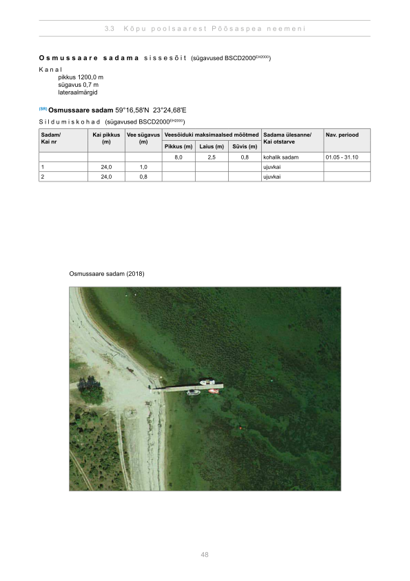
Depths and dimensional restrictions
The maximum permitted draught is 0.8 m. Published depths alongside are quay 1: 1.0 m and quay 2: 0.8 m. Depths are referenced to EH2000.[2]
Depths quay by quay (2)
| quay 1 | 1.0 m |
|---|---|
| quay 2 | 0.8 m |
Sources
- Sailing directions Lootsiraamat 3.3 — Kõpu poolsaarest Põõsaspea neemeni
- Sailing directions Lootsiraamat 3.3 — Kõpu poolsaarest Põõsaspea neemeni
Published 12 Sept 2026 · revision 4
Data: port register, record updated 9 Jun 2026.
Webcams
We do not have a webcam for this harbour yet.
Visitor observations
Sailors' experiences, not the harbour's official information.
Practical details and harbour documents
- Address
- Lääne maakond, Lääne-Nigula vald, Osmussaare küla / Odensholm, Ranna Ranna, 91217
- Navigation period
- 1. mai - 31. oktoober
- Position
- 59.27626° N, 23.41133° E
- Phone
- +372 56655777
- rita@osmussaar.ee
All services in the register
Veesõiduki sildumise võimaldamine · Joogivesi
Nearest harbours
Nõva, Dirhami, Haapsalu and the Matsalu approaches. Shallow, sheltered coast with small harbours close together. All harbours in Lääne county →